-
by
Joe Lombardi
National Interest
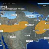
AccuWeather meteorologists have just unveiled their forecast for the winter of 2024-25 and have released a map of where in the US the most snowfall is expected.In the image above, higher-than-average snowfall is predicted for those areas shown in light blue, with most areas in the Northeast are expected to receive more snow this season than last winter. Areas in the darker shade are ...
-

by
Joe Lombardi
Weather
A days-long stretch of hot and humid weather will be followed by separate rounds of showers and thunderstorms that will lead to a change in the weather pattern.According to AccuWeather Senior Meteorologist Heather Zehr: "Temperatures early this week are topping out 10-15 degrees above normal from interior New England down through the mid-Atlantic, while coastal areas in New England ...
-

by
Joe Lombardi
Weather
The hottest days of the summer will linger into the first half of the weekend before an approaching cold front ignites a new round of severe storms that will lead to a big change in the weather pattern.Friday, July 28 is likely to be the warmest day of the week -- and perhaps of the year -- with the high temperature in the mid-90s, and a heat index (the combination of the temperature ...
-

by
Joe Lombardi
Weather
The start of summer is now just a couple of days away, and it will be followed by a change in the weather pattern.Skies could be hazy at times during the week due to ongoing smoke from Canadian wildfires, especially in areas farther north and west. (See the image above from AccuWeather.com.)Monday, June 19 will bring a mix of sun and clouds and a high temperature generally in the upper ...
-

by
Joe Lombardi
Breaking News
The most dangerous wind gusts that accompanied a cold front that is moving through the region have passed, but thousands remain without power in Connecticut.As of around 9 a.m. Saturday, Feb. 4, Eversource is reporting around 3,500 outages statewide, with United Illuminating reporting around 55 outages in its service territory.These municipalities are reporting the most ...
-

by
Joe Lombardi
Weather
Relief is coming following the most bitterly cold stretch of Christmas-time weather in more than 30 years.After continued cold on Monday, Dec. 26, there will be a gradual day-by-day increase in temperatures, leading to a big change in the weather pattern heading into New Year's Eve."A major shift in the jet stream will occur next week," AccuWeather Lead Long-Range Meteorologist Paul ...
-

by
Joe Lombardi
Weather
The arrival of a cold front will lead to a new round of showers and thunderstorms, followed by a big change in the weather pattern just as fall starts.It will be warm and dry through much of the day on Wednesday, Sept. 21, according to National Weather Service. The high temperature will be around 80 degrees.There could be scattered thunderstorms in some spots Wednesday evening in ...
-

by
Joe Lombardi
Weather
Change is in the air as summer officially starts.The most notable change in the weather pattern will be the increase in moisture, according to AccuWeather Senior Meteorologist Dan Pydynowski.The mainly dry stretch will be followed by scattered showers on the first day of summer on Tuesday, June 21, which will also usher in the start of more humid air through the end of the week.Tuesday ...
-

by
Joe Lombardi
Weather
The arrival of colder air will bring with it chances for some snow in parts of the region nearly a month after the start of spring and leading into the arrival of a potential Nor'easter."Spring is often a tug-of-war between winter and summer, but many might think snow is usually a thing of the past by the middle of April in much of the Northeast," according to AccuWeather.com. "However, ...
-

by
Joe Lombardi
Weather
A new winter storm that will bring a mix of snow, sleet, rain, and showers to the Northeast will be followed by a big change in the weather pattern.The storm system, due to arrive in this region after midnight Sunday morning, March 6, with its center now expected to be farther north and east. (See the image above.)"In the Northeast, the majority of ice or a wintry mix will generally be ...
-

by
Joe Lombardi
Weather
A storm system that will travel through the central and eastern United States is expected to bring a new round of snowfall to the region later in the week.Presidents' Day on Monday, Feb. 21 will be partly cloudy with a moderation in temperatures as the high reaches the upper 40s to the low 50s, according to the National Weather Service.The stormy weather pattern will arrive on Tuesday ...
-

by
Joe Lombardi
Weather
The arrival of a cold front bringing a storm system to the region will lead to a big change in the weather pattern in the days leading up to Thanksgiving.Sunday, Nov. 21 will be precipitation-free during the morning and afternoon with a high temperature in the low 50s under partly cloudy skies.Showers will arrive Sunday evening and continue through the overnight, according to the ...
-

by
Joe Lombardi
Weather
A change in the weather pattern will bring in the coldest air of the season, and as the air interacts with multiple storm systems, snow could develop as the calendar flips to November, according to AccuWeather.com forecasters."Could we be talking about snow across parts of the Midwest and Northeast?” AccuWeather Chief On-Air Meteorologist Bernie Rayno said. “Maybe.”That comment, made on ...
-

by
Joe Lombardi
Weather
Get set for a big change in the weather pattern after a quick-moving storm system pushes out of the coast.The storm, which brought periods of heavy rain, will wind down by around midday Sunday, April 25, followed by a period of scattered showers. A total of between a half-inch to an inch of rainfall is expected. (See the first image above.)The high temperature will be in the low 60s ...
-

by
Joe Lombardi
Weather
The final hours of what has been an active winter season of 2020-21 will look and feel -- fittingly -- like, well, winter.A total of 1.5 to 2 inches of liquid equivalent, mainly in the form of rain, is expected across the region as a storm system passes through in the next 24 hours or so, according to the National Weather Service. Sleet may briefly mix in before a changeover to all ...
-

by
Joe Lombardi
Weather
A significant winter storm is tracking farther south than expected and will bring just some light snow to the region, but there will be plenty more chances for more significant snowfall after that during what has been an extremely active weather pattern. Wednesday, Feb. 10 will be continued cold with areas of black ice in the morning and hazardous conditions on some untreated surfaces. ...
-

by
Joe Lombardi
Weather
The first snowfall projections have been released for a slow-moving late-week storm taking aim on the region.How Much Snow Did You Get? A Look At Totals Throughout Region From Nor'easterAccording to AccuWeather, the system expected for Thursday, Feb. 11 into Friday, Feb. 12 could result in accumulations of 6 to 12 inches for parts of the region. (Areas in dark blue in the first image ...
-

by
Joe Lombardi
Weather
The powerful, long-lasting Nor'easter delivered a parting shot in the form of light snow and snow squalls that created hazardous driving conditions just hours after many in the region had dug out from snowfall, with slippery road conditions into the morning commute on Wednesday, Feb. 3.Related story - How Much Snow Did You Get? A Look At Totals Throughout Region From Nor'easterWhile the ...
-

by
Joe Lombardi
Weather
The second winter storm in the first days of the new year brought accumulating snowfall to much of the region overnight Sunday, Jan. 3 into Monday, Jan. 4.While New York City and Long Island the immediate surrounding suburbs saw all rain with some sleet mixed in, some areas in upstate New York saw as much as half a foot of accumulation, including reports of 6 inches in Sullivan ...
-

by
Joe Lombardi
Weather
The arrival of a cold front will bring about a big change in the weather pattern.Saturday, Oct. 24 will be mostly cloudy and mild with the high temperature reaching the upper 60s.Patchy morning showers will be followed by a chance of rain after noontime.As the cold front moves late in the evening, temperatures will drop to an overnight low of around 40 degrees, and closer to the ...
-

by
Joe Lombardi
Weather
It's the first weekend of summer and it's going to feel like it.Warm temperatures, high humidity and scattered, pop-up thunderstorms -- all summer staples -- will mark the weather pattern for the days to come.The June solstice, marking the start of summer, is Saturday, June 20, at 5:44 p.m.Saturday will be partly sunny, hazy, hot and humid with a high temperature in the low to mid 80s. ...
-

by
Joe Lombardi
Weather
For the third straight day, a round of severe thunderstorms will move through the area during the evening commute.The storms will include downpours, lightning and gusty winds.The unsettled weather pattern that spawned tornadoes throughout the Midwest has triggered the stretch of storms in this region.Thursday, May 30 will be similar to Wednesday, with mostly cloudy skies during the day ...
-

by
Daily Voice
Breaking News
Related story: Storm System Winds Down With Big Change In Weather Pattern Coming This WeekThousands are without power in Dutchess County at midday on Sunday as a storm that brought accumulating snow, sleet and freezing rain winds down.Just before noontime, 3,541 outages are being reported in Dutchess by Central Hudson Gas & Electric Corp. The estimated restoration time is 2 p.m. ...


