-

by
Joe Lombardi
Weather
A Severe Thunderstorm Watch is now in effect for all of Connecticut as a new round of storms is expected to roll through with damaging winds and isolated tornadoes possible.The watch went into effect Thursday, July 21 at 11:40 p.m. and lasts until 8 p.m.Some of the storms could produce gusty winds, the National Weather Service noted."Heavy downpours are likely in storms, which could ...
-

by
Jillian Pikora
Breaking News
Hail, high winds, high temperatures, thunderstorms, and some flooding are all in the forecast across Pennsylvania for Tuesday, July 5, according to the National Weather Service."Damaging large hail", "large wind gusts", and fast-moving thunderstorms may hit homes in Pennsylvania, throughout the day but are expected to be at their worst after 2 p.m., the NWS forecasts.The Doppler radar ...
-

by
Jillian Pikora
Breaking News
Hail, high winds, high temperatures, thunderstorms, and tornadoes are all in the forecast across Pennsylvania for Thursday, June 16, according to the National Weather Service.Hail ranging from penny-sized to "large hail exceeding 1 inch in diameter inches in size," fast-moving thunderstorms, and 60-mile-per-hour winds may hit homes in Pennsylvania, throughout the day but are expected to ...
-

by
Joe Lombardi
Weather
Get set for multiple rounds of showers and thunderstorms in the region.There will be scattered showers and thunderstorms Wednesday morning, June 8, according to the National Weather Service.Showers and storms will taper off by late Wednesday morning, followed by gradual clearing.Wednesday's high temperature will be in the upper 70s.Precipitation is expected to return overnight with a ...
-

by
Joe Lombardi
Weather
A line of severe storms is moving through the region from west to east on Saturday afternoon, May 28.Storm activity is expected to continue into early Saturday evening.A slow moving cold front is triggering the system, according to the National Weather Service.Lightning alerts have been issued for parts of the region.Strong gusty winds in excess of 40 miles per hour, half-inch hail, and ...
-

by
Joe Lombardi
Weather
It's not over yet.Following scattered severe thunderstorms overnight, a new round of showers and storms is expected to develop on Saturday, May 28.The expected time frame for storm activity from around midday into early Saturday evening.A slow moving cold front will trigger storm activity, the National Weather Service in a Hazardous Weather Outlook statement issued early Saturday ...
-
by
David Cifarelli
Weather
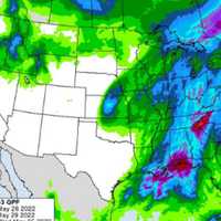
A rainy start to Memorial Day Weekend could be the reality for many residents in the Capital Region. As a low pressure system slowly moves across the country, rain is expected to reach the East Coast by Friday, May 27, according to the National Weather Service (NWS). As a low pressure system slowly moves east across the midsection of the country, rain will gradually push ...
-

by
Joe Lombardi
Weather
A Severe Thunderstorm Watch has just been issued for the region.It's in effect until 8 p.m. Monday, May 16.Scattered storms moving from west to east may produce damaging winds, hail, a few tornadoes, and isolated flash flooding, the National Weather Service said.Wind gusts of 60 miles per hour are expected in some spots where the storms are most severe.Most of the storm activity is now ...
-

by
Cecilia Levine
Weather
Strong winds and tornados are possible in this afternoon's storm heading to the region, forecasters say.Heavy rain is expected to begin falling in the northwestern part of the New Jersey, and parts of Pennsylvania between 3 and 5 p.m., the National Weather Service said. The storm will begin elsewhere between 4 and 8 p.m.Large hail, flash flooding, and wind gusts up to 60 mph are ...
-

by
Jillian Pikora
Breaking News
Thundershowers move in Saturday morning ushering in a soggy start to spring in Pennsylvania, according to the National Weather Service. Spring will officially arrive at 11:33 a.m. on Sunday, but it will be muddy as the previous 24 hours will have scattered storms, according to Pennsylvania Emergency Management Agency State Meteorologist Jeff Jumper. The most severe storms are expected ...
-

by
Joe Lombardi
Weather
It's been a stormy stretch of weather in the days leading up to Halloween.The largest round of heavy rain, with local downpours and flash flooding, swept through the region Friday night, Oct. 29 through the overnight hours into around daybreak on Saturday, Oct. 30.After a brief respite from the rain during the morning and early afternoon, rain, heavy at times, will return in the middle ...
-

by
Joe Lombardi
Weather
A powerful Nor'easter that is now moving through New England brought even more rainfall than originally projected to the region, along with scattered flash flooding, and damaging wind gusts up to 60 miles per hour that led to thousands of power outages.Here are some of the highest reported rainfall totals from around the region on Tuesday, Oct. 26 and early in the morning on Wednesday, ...


